Other Case Studies
The SMART partnership supports improved law enforcement and biological monitoring in protected areas around the world. They came to Refractions to build a software tool to help meet their needs.
Hectares BC – Biodiversity BC on behalf of a broad partnership
Biodiversity BC and its government and non-government partners were looking for regional-level environmental statistics. Refractions proposed a new approach to generating GIS summaries, using the power of a relational database and web tools to provide GIS analysis to users who previously had no access to it.
Automated Route Planning for Meter Reading – City of Vancouver
The City of Vancouver collects water readings from thousands of residences and businesses, but has never optimized the pedestrian routes the readers take. Refractions developed algorithms to create the most efficient routes of the correct length for readers.
Digital Road Atlas – BC Integrated Land Management Bureau
Refractions provides full-service support for the British Columbia Digital Roads Atlas – systems design, maintenance, data conflation, client service, and rapid response.
Caribou Habitat Assessment and Supply Estimator – Wildlife Infometrics Inc.
Refractions converted a legacy habitat modelling system based on ArcView 3.X to ArcGIS 9.2, and automated the workflow to provide faster turnaround time for model runs.
Line Cleaner – BC Ministry of Forests
The British Columbia Ministry of Forests needed a tool to conflate multiple roads databases into a single working layer. Refractions delivered the algorithms and a user interface based on the uDig platform.
Interest Reports – BC Ministry of Agriculture & Lands
Refractions developed an ArcMap extension to automate the calculation of standard reports joining a massive shape-file archive with a large Oracle database.
Mobile GIS – UN Food & Agriculture Organization
UN FAO needed a data collection tool that could run disconnected and didn't have a per-seat licensing cost. Refractions delivered a simple tool using the uDig desktop platform.
Open Web Services, Phase 3 – Open Geospatial Consortium
The Open Geospatial Consortium runs regular “testbed” projects to field-test new concepts in geospatial interoperability. Refractions was a part of the OWS-3 initiative, and built a uDig-based “GeoDSS” client to provide access to several other OGC standard services, including a prototype GeoVideo service.
Natural Language Spatial Search Engine for Rental Places-Rento
Rento is a free web service that makes it easy to find a place to rent in Greece. Powered by PostgreSQL and PostGIS, it provides ad listings with photographs displayed on a map. Searching is accomplished through map navigation and natural language processing, with the search engine being capable of answering complex (spatial) questions such as "flat near the University of Athens" or "loft up to 800 euros near a metro station" (in greek).
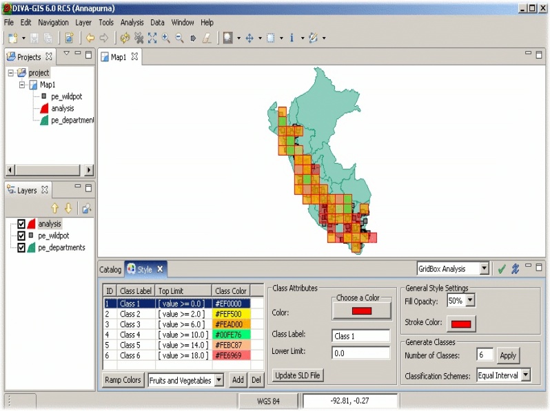
uDig Training Session – International Potato Center, Peru
The International Potato Center (CIP) seeks to reduce poverty and achieve food security on a sustained basis in developing countries through scientific research and related activities on potato, sweet potato, and other root and tuber crops and on the improved management of natural resources in the Andes and other mountain areas. The mission of CIP includes the maintenance of the international genebank for potatoes and sweet potatoes as held in-trust from FAO (Food and Agricultural Organization).
As part of its mission, CIP developed a data curation tool, DIVA-GIS, to transfer descriptive location data into geo-coded decimal data sets, and carry out biodiversity analysis and crop prediction based on climate data.
The first version of DIVA-GIS was built in Delphi, using a proprietary GIS engine with a favorable license. CIP decided to move this application to open source to remove the dependency of a proprietary license in anticipation. At the same time, CIP decided to overhaul the application architecture, to move to a cross-platform framework, and to open up the source code for peer-review.
After comparison with several other potential candidates in Java CIP finally adopted uDig as a spatial framework. uDig was the choice because:
- it is built on both an established GIS independent framework (Eclipse RCP);
- it includes a well-tested GIS library; and,
- it has a very favorable open source licensing model.
CIP wanted to get started with uDig as quickly as possible, so they contracted with Refractions to deliver a week-long training course that covered the essentials for new uDig developers:
- The Eclipse RCP plug-in system, and building applications based on Eclipse;
- The uDig plug-ins, and what their important extension points are;
- The Geotools library, what components are available and how to build them; and,
- How to integrate and build all these components into a working application.
Refractions delivered the course on-site in Lima, Peru, to a class that included local developers from CIP, and a wide range of other developers from the United Nations Food and Agriculture Organization (FAO) interested in moving into RCP/uDig development for their own purposes.