Other Case Studies
The SMART partnership supports improved law enforcement and biological monitoring in protected areas around the world. They came to Refractions to build a software tool to help meet their needs.
Hectares BC – Biodiversity BC on behalf of a broad partnership
Biodiversity BC and its government and non-government partners were looking for regional-level environmental statistics. Refractions proposed a new approach to generating GIS summaries, using the power of a relational database and web tools to provide GIS analysis to users who previously had no access to it.
Automated Route Planning for Meter Reading – City of Vancouver
The City of Vancouver collects water readings from thousands of residences and businesses, but has never optimized the pedestrian routes the readers take. Refractions developed algorithms to create the most efficient routes of the correct length for readers.
Digital Road Atlas – BC Integrated Land Management Bureau
Refractions provides full-service support for the British Columbia Digital Roads Atlas – systems design, maintenance, data conflation, client service, and rapid response.
Caribou Habitat Assessment and Supply Estimator – Wildlife Infometrics Inc.
Refractions converted a legacy habitat modelling system based on ArcView 3.X to ArcGIS 9.2, and automated the workflow to provide faster turnaround time for model runs.
Line Cleaner – BC Ministry of Forests
The British Columbia Ministry of Forests needed a tool to conflate multiple roads databases into a single working layer. Refractions delivered the algorithms and a user interface based on the uDig platform.
Interest Reports – BC Ministry of Agriculture & Lands
Refractions developed an ArcMap extension to automate the calculation of standard reports joining a massive shape-file archive with a large Oracle database.
Mobile GIS – UN Food & Agriculture Organization
UN FAO needed a data collection tool that could run disconnected and didn't have a per-seat licensing cost. Refractions delivered a simple tool using the uDig desktop platform.
Open Web Services, Phase 3 – Open Geospatial Consortium
The Open Geospatial Consortium runs regular “testbed” projects to field-test new concepts in geospatial interoperability. Refractions was a part of the OWS-3 initiative, and built a uDig-based “GeoDSS” client to provide access to several other OGC standard services, including a prototype GeoVideo service.
Natural Language Spatial Search Engine for Rental Places-Rento
Rento is a free web service that makes it easy to find a place to rent in Greece. Powered by PostgreSQL and PostGIS, it provides ad listings with photographs displayed on a map. Searching is accomplished through map navigation and natural language processing, with the search engine being capable of answering complex (spatial) questions such as "flat near the University of Athens" or "loft up to 800 euros near a metro station" (in greek).
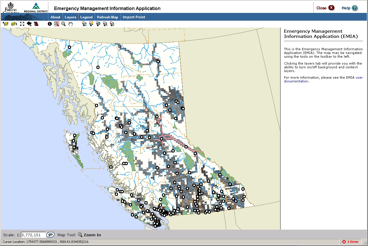
Emergency Management Information Application (EMIA) – Regional District of Fraser-Fort George
Project Background
The Regional District Fraser-Fort George (RDFFG) encompasses a vast geographical extent with over 100,000 residents residing in 52,000 square kilometers. They are currently responsible for providing 911 services and supporting disaster management. Due to the wide geographical extent and rural nature of the area, several challenges are presented when supporting emergency management operations. Some of these difficulties include: addresses not geocoding properly against roads data; access point may differ from the addressed point; unincorporated communities may have different names and assumed boundaries; an address may not be known if the call is from a cell phone or VOIP; and paper maps, which are still used widely in dispatch vehicles in rural areas, may not be current. The result of all of these circumstances is that emergency responders may spend precious time searching for an address location.
The Solution
To make it technically feasible for the RDFFG and its partners to expand their primary role of providing emergency 911 services, a web application has been developed to support the compilation, quality assurance, presentation and analysis of geospatial data. The Emergency Management Information Application (EMIA) will allow these jurisdictions to include emergency and disaster planning and management as part of their business operations.
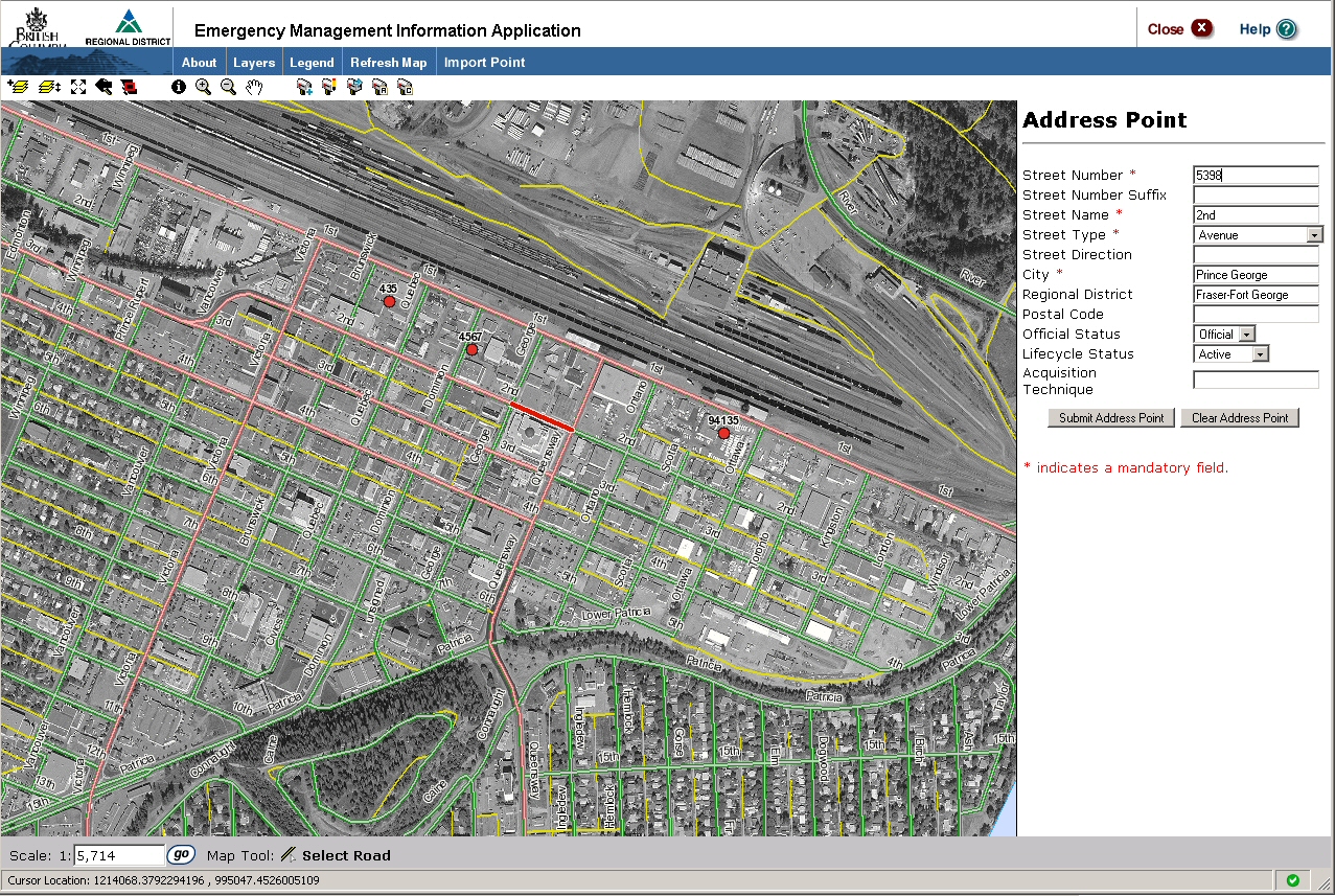
The spatial data essential for the success of the EMIA includes address points, a comprehensive and accurate road network, sites data representing critical infrastructure as well as access to other selected third-party CGDI systems. The application's functionality includes: the ability to show roads, cadastral data, and other context layers; defined and stored areas of interest; new addresses loaded, delineated, moved and attributes modified; suggested changes to road geometry and attributes; attributes of site types entered and modified; and automated and manual quality assurance treatments.
The Result
The architecture, using OGC standards, is flexible in allowing staff to edit, update, perform quality assurance and validate information pertaining to address points, roads and specific sites. Using OGC standards will also allow for greater extensibility, and simplify collaboration with other systems.
The technology chosen integrates with the RDFFG infrastructure, using ArcSDE as the backend database, and ArcMap to view and edit points directly in ArcSDE as necessary.
The application will be extendable to incorporate future partners of the RDGGD including the Cariboo, the Bulkley-Nechako and Kitimat-Stikine Regional Districts. A seamless exchange and sharing of geospatial data between various levels of government is also possible. These partners are the Provincial Branch of Base Mapping and Geomatic Services (BMGS), the Integrated Cadastre Information Society (ICIS) and the Canadian Geospatial Data Infrastructure (CGDI) to name a few.
The overall benefits include the ability to provide stronger support to emergency 911 and disaster management, the capacity to partner with local government to enable fast updating of roads and sites data and support for public safety.